Using Te Ara -
The Encyclopedia of New Zealand
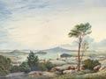
1. Waitemata Harbour
L.I. Develop our knowledge of Auckland and the Tamaki River.
Familiarise ourselves with an online NZ encyclopaedia.
Use our skimming and scanning skills.
Enter Waitemata into the search box and use that page to answer these questions.
What sort of landform is the Waitemata harbour?
It is a drowned river valley which is stretched from Riverhead in the north west to Tamaki River in the east.
Why was it chosen to be New Zealand’s capital?
It was chosen to be New Zealand’s capital because of its tidal flats and the higher mangroves reaches to the west and sandy bays with sandstone cliffs along the eastern shores.
What does Waitemata mean?
The word Waitemata means obsidian waters.
|
Auckland’s chief port - The Auckland’s port on the Waitemata was basic to the advance of the city and place.
Viaduct basin - The viaduct basin was the site of old fishing harbour which was redeveloped in the middle 1990’s as a site where the royal New Zealand Yacht Squadron could host the America's cup in 1999 and 2003.
Westhaven - The Westhaven Marina, with 1,800 berths, is the largest managed marina in Australasia, and a symbol of Aucklanders’ love of sailing.
Harbour bridge - The Auckland Harbour Bridge (1,020 m long) was opened in 1959 to link the Auckland isthmus with the north.
Greenhithe bridge - The Greenhithe Bridge was built in 1975 as an alternative harbour crossing, spanning the upper Waitematā from Hobsonville to Greenhithe on the North Shore.
Natural features - Natural features of the Waitematā include Meola reef (also known as Te Tokoroa, meaning ‘a long reef’), a rocky sub-marine promontory.
No comments:
Post a Comment
Note: only a member of this blog may post a comment.